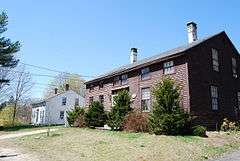
National Register of Historic Places listings in Charlestown, Rhode Island
This is a list of Registered Historic Places in Charlestown, Rhode Island.
- This National Park Service list is complete through NPS recent listings posted December 2, 2016.[1]
| [2] |
Name on the Register[3] |
Image |
Date listed[4] |
Location |
City or town |
Description |
|---|
| 1 |
Babcock House |
Upload image |
000000001976-01-01-0000January 1, 1976
(#76000008) |
Main St.
41°20′14″N 71°42′43″W / 41.337222°N 71.711944°W / 41.337222; -71.711944 (Babcock House) |
Charlestown |
|
| 2 |
Carolina Village Historic District |
Upload image |
000000001974-05-02-0000May 2, 1974
(#74000009) |
Charlestown
41°27′31″N 71°39′51″W / 41.458611°N 71.664167°W / 41.458611; -71.664167 (Carolina Village Historic District) |
Charlestown and Richmond |
|
| 3 |
District Schoolhouse No. 2 |
Upload image |
000000001980-01-04-0000January 4, 1980
(#80000016) |
Old Post Rd.
41°23′07″N 71°39′04″W / 41.385278°N 71.651111°W / 41.385278; -71.651111 (District Schoolhouse No. 2) |
Charlestown |
|
| 4 |
Foster Cove Archeological Site |
Upload image |
000000001980-05-06-0000May 6, 1980
(#80000018) |
Address Restricted
|
Charlestown |
|
| 5 |
Historic Village of the Narragansetts in Charlestown |
Upload image |
000000001973-05-07-0000May 7, 1973
(#73000008) |
Bounded by Route 112, U.S. Route 1, King's Factory Road (Bureau of Indian Affairs Route 411), and Route 91
41°24′37″N 71°40′03″W / 41.4104°N 71.6674°W / 41.4104; -71.6674 (Historic Village of the Narragansetts in Charlestown) |
Charlestown |
|
| 6 |
Indian Burial Ground |
Upload image |
000000001970-04-28-0000April 28, 1970
(#70000005) |
Narrow Lane
41°23′48″N 71°38′00″W / 41.396667°N 71.633333°W / 41.396667; -71.633333 (Indian Burial Ground) |
Charlestown |
|
| 7 |
Joseph Jeffrey House |
Upload image |
000000001978-03-08-0000March 8, 1978
(#78000017) |
Old Mill Road
41°25′47″N 71°39′54″W / 41.429722°N 71.665°W / 41.429722; -71.665 (Joseph Jeffrey House) |
Charlestown |
|
| 8 |
Shannock Historic District |
|
000000001983-08-04-0000August 4, 1983
(#83000005) |
Main St., N. Shannock and W. Shannock Rds.
41°26′53″N 71°38′28″W / 41.448056°N 71.641111°W / 41.448056; -71.641111 (Shannock Historic District) |
Charlestown and Richmond |
|
| 9 |
Sheffield House |
Upload image |
000000001976-01-01-0000January 1, 1976
(#76000011) |
Beach Rd.
41°20′09″N 71°42′32″W / 41.335833°N 71.708889°W / 41.335833; -71.708889 (Sheffield House) |
Charlestown |
|
| 10 |
Joseph Stanton House |
Upload image |
000000001980-01-11-0000January 11, 1980
(#80000026) |
U.S. Route 1
41°21′25″N 71°42′17″W / 41.356944°N 71.704722°W / 41.356944; -71.704722 (Joseph Stanton House) |
Charlestown |
|
See also
References
|
|---|
|
| Topics | | |
|---|
|
| Lists by county | |
|---|
|
| Lists by city | Bristol Coutny | |
|---|
| Kent County | |
|---|
| Newport County | |
|---|
| Providence County | |
|---|
| Washington County | |
|---|
|
|---|
|
-
 Category Category
-
 NRHP portal NRHP portal
-
 Massachusetts portal Massachusetts portal
|

_(extra_close)_(US48).svg.png)