| [2] |
Name on the Register[3] |
Image |
Date listed[4] |
Location |
City or town |
Description |
|---|
| 1 |
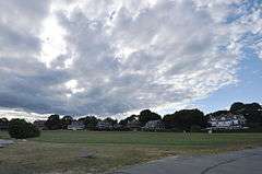
Artillery Park |
|
000000001973-03-07-0000March 7, 1973
(#73000054) |
North Rd. and Narragansett Ave.
41°29′47″N 71°22′29″W / 41.496389°N 71.374722°W / 41.496389; -71.374722 (Artillery Park) |
Jamestown |
|
| 2 |
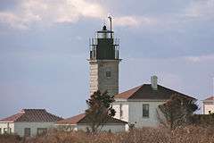
Beavertail Light |
|
000000001977-12-12-0000December 12, 1977
(#77000024) |
Beavertail Rd.
41°26′58″N 71°23′59″W / 41.449444°N 71.399722°W / 41.449444; -71.399722 (Beavertail Light) |
Jamestown |
Continuously operating gateway to Narragansett Bay since 1749; part of the Lighthouses of Rhode Island Thematic Resource (TR)
|
| 3 |
Thomas Carr Farmstead Site (Keeler Site RI-707) |
Upload image |
000000001984-11-01-0000November 1, 1984
(#84000356) |
Address Restricted
|
Jamestown |
|
| 4 |
Conanicut Battery |
Upload image |
000000001973-07-02-0000July 2, 1973
(#73000055) |
West of Beaver Tail Rd.
41°28′49″N 71°23′38″W / 41.480278°N 71.393889°W / 41.480278; -71.393889 (Conanicut Battery) |
Jamestown |
|
| 5 |
Conanicut Island Lighthouse |
|
000000001988-02-25-0000February 25, 1988
(#87001698) |
64 N. Bay View Ave.
41°34′24″N 71°22′21″W / 41.573333°N 71.3725°W / 41.573333; -71.3725 (Conanicut Island Lighthouse) |
Jamestown |
part of the Lighthouses of Rhode Island TR
|
| 6 |
Dutch Island Lighthouse |
|
000000001988-02-25-0000February 25, 1988
(#87001701) |
Southern end of Dutch Island
41°29′44″N 71°24′16″W / 41.495556°N 71.404444°W / 41.495556; -71.404444 (Dutch Island Lighthouse) |
Jamestown |
part of the Lighthouses of Rhode Island TR
|
| 7 |
Fort Dumpling Site |
|
000000001972-03-16-0000March 16, 1972
(#72000021) |
Fort Wetherill
41°28′38″N 71°21′28″W / 41.4773°N 71.3578°W / 41.4773; -71.3578 (Fort Dumpling Site) |
Jamestown |
Fort Wetherill was built on the site of Fort Dumpling.
|
| 8 |
Friends Meetinghouse |
|
000000001973-03-07-0000March 7, 1973
(#73000276) |
North Rd. and Weeden Lane
41°30′52″N 71°22′31″W / 41.514444°N 71.375278°W / 41.514444; -71.375278 (Friends Meetinghouse) |
Jamestown |
|
| 9 |
Hazard Farmstead (Joyner Site RI-706) |
Upload image |
000000001984-11-01-0000November 1, 1984
(#84000365) |
Address Restricted
|
Jamestown |
|
| 10 |
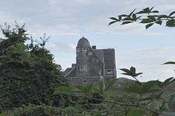
Horsehead-Marbella |
|
000000001999-06-16-0000June 16, 1999
(#99000675) |
240 Highland Dr.
41°28′34″N 71°22′32″W / 41.476111°N 71.375556°W / 41.476111; -71.375556 (Horsehead-Marbella) |
Jamestown |
|
| 11 |
Jamestown Archeological District |
Upload image |
000000001989-12-10-0000December 10, 1989
(#83004869) |
Address Restricted
|
Jamestown |
|
| 12 |
Jamestown Windmill |
|
000000001973-03-14-0000March 14, 1973
(#73000057) |
North Rd., north of Weeden Lane
41°30′59″N 71°22′28″W / 41.516389°N 71.374444°W / 41.516389; -71.374444 (Jamestown Windmill) |
Jamestown |
|
| 13 |
Old Friends Archeological Site |
Upload image |
000000001995-11-07-0000November 7, 1995
(#95001269) |
Address Restricted
|
Jamestown |
|
| 14 |
Shoreby Hill Historic District[5] |
|
000000002011-09-15-0000September 15, 2011
(#11000674) |
Roughly bounded by Whittier Rd., Prudence Ln., Emerson Rd., Conanicus Ave., Knowles Ct., Coronado St. & Longfellow Rd.
41°29′57″N 71°22′08″W / 41.499167°N 71.368889°W / 41.499167; -71.368889 (Shoreby Hill Historic District) |
Jamestown |
|
| 15 |
Windmill Hill Historic District |
|
000000001978-10-02-0000October 2, 1978
(#78000067) |
Eldred Ave. and N. Main Rd.
41°31′04″N 71°22′44″W / 41.517778°N 71.378889°W / 41.517778; -71.378889 (Windmill Hill Historic District) |
Jamestown |
|


_(extra_close)_(US48).svg.png)