| [5] |
Name on the Register |
Image |
Date listed[6] |
Location |
City or town |
Description |
|---|
| 1 |
Astor Building |
|
000000001984-09-07-0000September 7, 1984
(#84002938) |
1203 Commercial St.
46°11′19″N 123°49′48″W / 46.188667°N 123.829883°W / 46.188667; -123.829883 (Astor Building) |
Astoria |
|
| 2 |
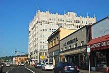
John Jacob Astor Hotel |
|
000000001979-11-16-0000November 16, 1979
(#79002046) |
1401 Commercial St.
46°11′19″N 123°49′42″W / 46.18873056°N 123.8282833°W / 46.18873056; -123.8282833 (John Jacob Astor Hotel) |
Astoria |
Opened in 1924 and was originally named the Hotel Astoria; renamed in 1951 and closed as a hotel in 1968. Now in use as an apartment building.
|
| 3 |
Astoria City Hall (old) |
|
000000001984-09-07-0000September 7, 1984
(#84002940) |
1618 Exchange St.
46°11′18″N 123°49′31″W / 46.18838333°N 123.8254028°W / 46.18838333; -123.8254028 (Astoria City Hall (old)) |
Astoria |
|
| 4 |
Astoria Column |
|
000000001974-05-02-0000May 2, 1974
(#74001681) |
Coxcomb Hill
46°10′53″N 123°49′03″W / 46.181325°N 123.8175194°W / 46.181325; -123.8175194 (Astoria Column) |
Astoria |
|
| 5 |
Astoria Downtown Historic District |
|
000000001998-06-22-0000June 22, 1998
(#98000631) |
Boundary roughly from the Columbia R. to Exchange St and from 7th St. to 17th St.
46°11′20″N 123°49′51″W / 46.189°N 123.83075°W / 46.189; -123.83075 (Astoria Downtown Historic District) |
Astoria |
|
| 6 |
Astoria Elks Building |
|
000000001990-06-01-0000June 1, 1990
(#90000843) |
453 11th St.
46°11′16″N 123°49′55″W / 46.18785°N 123.8320639°W / 46.18785; -123.8320639 (Astoria Elks Building) |
Astoria |
|
| 7 |
Astoria Fire House No. 2 |
|
000000001984-09-07-0000September 7, 1984
(#84002946) |
2968 Marine Dr.
46°11′26″N 123°48′40″W / 46.19043056°N 123.811175°W / 46.19043056; -123.811175 (Astoria Fire House No. 2) |
Astoria |
|
| 8 |
Astoria Marine Construction Company Historic District |
|
000000002014-01-08-0000January 8, 2014
(#13001058) |
92134 Front Rd.
46°08′41″N 123°51′45″W / 46.144818°N 123.862404°W / 46.144818; -123.862404 (Astoria Marine Construction Company Historic District) |
Astoria vicinity |
|
| 9 |
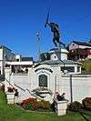
Astoria Victory Monument |
|
000000001984-11-15-0000November 15, 1984
(#84000466) |
Columbia St., Bond and W. Marine Dr.
46°11′23″N 123°50′53″W / 46.189639°N 123.847944°W / 46.189639; -123.847944 (Astoria Victory Monument) |
Astoria |
|
| 10 |
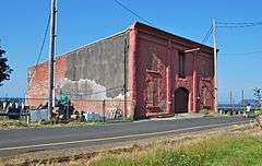
Astoria Wharf and Warehouse Company |
|
000000001984-06-14-0000June 14, 1984
(#84002949) |
Columbia River waterfront between 3rd and 4th Sts.
46°11′29″N 123°50′20″W / 46.191436°N 123.838981°W / 46.191436; -123.838981 (Astoria Wharf and Warehouse Company) |
Astoria |
|
| 11 |
Bald Point Site (35CLT23) |
Upload image |
000000001997-09-10-0000September 10, 1997
(#97000983) |
Address restricted[lower-alpha 1][7]
|
Cannon Beach vicinity |
This archaeological site associated with the Tillamook people features a shell midden and possible house pit, dating to ca. 1550 CE. Parts of the site have been lost to coastal erosion, but the remaining portions appear mostly secure.[8]
|
| 12 |
Robert Rensselaer Bartlett House |
|
000000001986-06-05-0000June 5, 1986
(#86001236) |
1215 15th St.
46°10′59″N 123°49′36″W / 46.182928°N 123.826747°W / 46.182928; -123.826747 (Robert Rensselaer Bartlett House) |
Astoria |
|
| 13 |
Peter L. Cherry House |
|
000000001984-09-07-0000September 7, 1984
(#84002952) |
836 15th St.
46°11′08″N 123°49′35″W / 46.18548611°N 123.8264889°W / 46.18548611; -123.8264889 (Peter L. Cherry House) |
Astoria |
|
| 14 |
Clatsop County Courthouse |
|
000000001984-04-05-0000April 5, 1984
(#84002954) |
749 Commercial St.
46°11′20″N 123°50′07″W / 46.188783°N 123.835192°W / 46.188783; -123.835192 (Clatsop County Courthouse) |
Astoria |
|
| 15 |
Clatsop County Jail (Old) |
|
000000001983-05-19-0000May 19, 1983
(#83002145) |
732 Duane St.
46°11′19″N 123°50′08″W / 46.18855833°N 123.8354806°W / 46.18855833; -123.8354806 (Clatsop County Jail (Old)) |
Astoria |
|
| 16 |
Ecola Point Site (35CLT21) |
Upload image |
000000001997-09-10-0000September 10, 1997
(#97000984) |
Address restricted[lower-alpha 1][7]
|
Cannon Beach vicinity |
Remains of a Tillamook village and two dense shell middens at this archaeological site have been dated to span roughly 1100–1700 CE. This large and complex site is mostly intact, and has extensive potential to yield information for future research.[9]
|
| 17 |
Erickson–Larsen Ensemble |
|
000000001991-02-20-0000February 20, 1991
(#91000055) |
3025–3027 Marine Dr.
46°11′26″N 123°48′37″W / 46.19049444°N 123.8102361°W / 46.19049444; -123.8102361 (Erickson–Larsen Ensemble) |
Astoria |
Consists of two buildings: a house built in 1877 and a small apartment building (the Ludwig Larsen apartments) built c. 1885.
|
| 18 |
Albert W. Ferguson House |
|
000000001984-09-07-0000September 7, 1984
(#84002955) |
1661 Grand Ave.
46°11′09″N 123°49′29″W / 46.185889°N 123.824639°W / 46.185889; -123.824639 (Albert W. Ferguson House) |
Astoria |
|
| 19 |
Ferdinand Fisher House |
|
000000001987-05-06-0000May 6, 1987
(#87000668) |
687 12th St.
46°11′11″N 123°49′50″W / 46.18639444°N 123.83055°W / 46.18639444; -123.83055 (Ferdinand Fisher House) |
Astoria |
|
| 20 |
Capt. George Flavel House and Carriage House |
|
000000001980-11-28-0000November 28, 1980
(#80003307) |
441 8th St.
46°11′17″N 123°50′06″W / 46.18813889°N 123.8350722°W / 46.18813889; -123.8350722 (Capt. George Flavel House and Carriage House) |
Astoria |
Queen Anne style house, built in 1885, now a house museum. Featured in The Goonies.
|
| 21 |
Captain George Conrad Flavel House |
|
000000001986-06-05-0000June 5, 1986
(#86001222) |
627 15th St.
46°11′12″N 123°49′39″W / 46.18678056°N 123.8273667°W / 46.18678056; -123.8273667 (Captain George Conrad Flavel House) |
Astoria |
House built in 1901.
|
| 22 |
George C. and Winona Flavel House |
|
000000001991-02-19-0000February 19, 1991
(#91000054) |
818 Grand Ave.
46°11′11″N 123°50′04″W / 46.18649722°N 123.834575°W / 46.18649722; -123.834575 (George C. and Winona Flavel House) |
Astoria |
House built in 1879.
|
| 23 |
Martin Foard House |
|
000000001986-06-05-0000June 5, 1986
(#86001221) |
690 17th St.
46°11′11″N 123°49′26″W / 46.18641667°N 123.8237833°W / 46.18641667; -123.8237833 (Martin Foard House) |
Astoria |
|
| 24 |
Fort Astoria |
|
000000001966-10-15-0000October 15, 1966
(#66000639) |
15th and Exchange Sts.
46°11′18″N 123°49′39″W / 46.18820278°N 123.8274694°W / 46.18820278; -123.8274694 (Fort Astoria) |
Astoria |
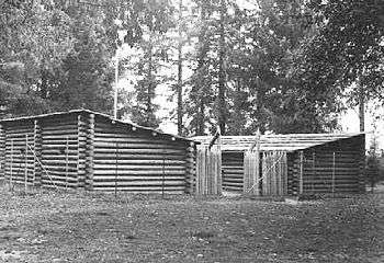
John Jacob Astor attempted to break the British monopoly on the Pacific Northwest fur trade starting with construction of this fortified trading post in 1811. The fort subsequently became an important part of the American territorial claim to the Oregon Country. Astor sold the fort to the British North West Company in 1813.[10]
|
| 25 |
Fort Clatsop National Memorial |
|
000000001966-10-15-0000October 15, 1966
(#66000640) |
4.5 mi. S of Astoria
46°08′03″N 123°52′45″W / 46.134195°N 123.879054°W / 46.134195; -123.879054 (Fort Clatsop National Memorial) |
Astoria vicinity |
|
| 26 |
Fort Stevens |
|
000000001971-09-22-0000September 22, 1971
(#71000678) |
Fort Stevens State Park
46°12′03″N 123°57′48″W / 46.200833°N 123.963333°W / 46.200833; -123.963333 (Fort Stevens) |
Hammond |
|
| 27 |
William and Nellie Fullam House |
|
000000001991-10-25-0000October 25, 1991
(#91001570) |
781 S. Promenade
45°59′22″N 123°55′50″W / 45.989471°N 123.930645°W / 45.989471; -123.930645 (William and Nellie Fullam House) |
Seaside |
|
| 28 |
Rev. William S. Gilbert House |
|
000000001993-06-03-0000June 3, 1993
(#93000457) |
725 11th St.
46°11′10″N 123°49′55″W / 46.18604444°N 123.8320639°W / 46.18604444; -123.8320639 (Rev. William S. Gilbert House) |
Astoria |
|
| 29 |
Goodwin–Wilkinson Farmhouse |
|
000000001992-03-09-0000March 9, 1992
(#92000128) |
US-101 west of Cullaby Lake
46°05′13″N 123°55′00″W / 46.086912°N 123.916655°W / 46.086912; -123.916655 (Goodwin–Wilkinson Farmhouse) |
Warrenton vicinity |
|
| 30 |
Grace Episcopal Church and Rectory[lower-alpha 2] |
|
000000001984-09-07-0000September 7, 1984
(#84002957) |
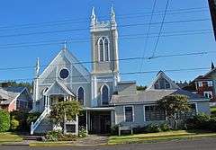
1545 Franklin Ave.
46°11′13″N 123°49′35″W / 46.186858°N 123.826297°W / 46.186858; -123.826297 (Grace Episcopal Church and Rectory) |
Astoria |
|
| 31 |
Grace Episcopal Church Rectory, Old[lower-alpha 2] |
|
000000001990-03-09-0000March 9, 1990
(#90000375) |
637 16th St.
46°11′12″N 123°49′33″W / 46.186742°N 123.825764°W / 46.186742; -123.825764 (Grace Episcopal Church Rectory, Old) |
Astoria |
|
| 32 |
Capt. J. H. D. Gray House |
|
000000001984-09-07-0000September 7, 1984
(#84002958) |
1687 Grand Ave.
46°11′09″N 123°49′28″W / 46.185972°N 123.824306°W / 46.185972; -123.824306 (Capt. J. H. D. Gray House) |
Astoria |
|
| 33 |
John N. Griffin House |
|
000000001984-10-25-0000October 25, 1984
(#84000119) |
1643 Grand Ave.
46°11′09″N 123°49′29″W / 46.185936°N 123.824813°W / 46.185936; -123.824813 (John N. Griffin House) |
Astoria |
|
| 34 |
Haller–Black House |
|
000000001991-10-25-0000October 25, 1991
(#91001568) |
841 S. Promenade
45°59′21″N 123°55′51″W / 45.989202°N 123.930699°W / 45.989202; -123.930699 (Haller–Black House) |
Seaside |
|
| 35 |
Hlilusqahih Site (35CLT37) |
Upload image |
000000001984-04-26-0000April 26, 1984
(#84002959) |
Address restricted[lower-alpha 1][7]
|
Knappa |
|
| 36 |
John Hobson House |
|
000000001978-02-17-0000February 17, 1978
(#78002281) |
469 Bond St.
46°11′23″N 123°50′17″W / 46.189611°N 123.838°W / 46.189611; -123.838 (John Hobson House) |
Astoria |
|
| 37 |
Gustavus Holmes House |
|
000000001984-10-25-0000October 25, 1984
(#84000121) |
682 34th St.
46°11′26″N 123°48′20″W / 46.190664°N 123.805425°W / 46.190664; -123.805425 (Gustavus Holmes House) |
Astoria |
|
| 38 |
Indian Creek Village Site (35CLT12) |
Upload image |
000000001997-09-10-0000September 10, 1997
(#97000982) |
Address restricted[lower-alpha 1][7]
|
Cannon Beach vicinity |
|
| 39 |
Indian Point Site (35 CLT 34) |
Upload image |
000000001984-05-09-0000May 9, 1984
(#84002960) |
Address restricted[lower-alpha 1][7]
|
Svensen |
|
| 40 |
Isabella Shipwreck Site and Remains |
Upload image |
000000001989-09-21-0000September 21, 1989
(#89001385) |
Address restricted[lower-alpha 1][7]
|
Astoria vicinity |
|
| 41 |
Peter and Maria Larson House |
|
000000001990-03-09-0000March 9, 1990
(#90000374) |
611 31st St.
46°11′27″N 123°48′34″W / 46.19078889°N 123.8094722°W / 46.19078889; -123.8094722 (Peter and Maria Larson House) |
Astoria |
|
| 42 |
Charles David Latourette House |
|
000000001984-03-22-0000March 22, 1984
(#84002962) |
683 D St.
46°01′16″N 123°55′08″W / 46.02101111°N 123.9189833°W / 46.02101111; -123.9189833 (Charles David Latourette House) |
Gearhart |
|
| 43 |
Christian Leinenweber House |
|
000000001999-05-20-0000May 20, 1999
(#99000604) |
3480 Franklin Ave.
46°11′30″N 123°48′17″W / 46.191651°N 123.804785°W / 46.191651; -123.804785 (Christian Leinenweber House) |
Astoria |
|
| 44 |
Lightship WAL-604, COLUMBIA |
|
000000001989-12-20-0000December 20, 1989
(#89002463) |
1792 Maritime Dr.
46°11′25″N 123°49′26″W / 46.19038056°N 123.8240056°W / 46.19038056; -123.8240056 (Lightship WAL-604, COLUMBIA) |
Astoria |
Retired in 1979 as the last lightship to be stationed at the Columbia River Bar — or anywhere on the Pacific coast of the United States — WAL-604 retains the best historic integrity of the last generation of U.S. Coast Guard lightships after 1939. WAL-604, built in 1950, and its relatives closely resembled earlier lightship types in external appearance, but were a distinct departure in their overall design.[10]
|
| 45 |
Noonan–Norblad House |
|
000000001988-03-31-0000March 31, 1988
(#88000303) |
1625 Grand Ave.
46°11′09″N 123°49′30″W / 46.185972°N 123.825028°W / 46.185972; -123.825028 (Noonan–Norblad House) |
Astoria |
|
| 46 |
Judge C. H. Page House |
|
000000001985-06-06-0000June 6, 1985
(#85001177) |
1393 Franklin Ave.
46°11′12″N 123°49′43″W / 46.18676944°N 123.8285806°W / 46.18676944; -123.8285806 (Judge C. H. Page House) |
Astoria |
|
| 47 |
Charles Preston House |
|
000000001991-10-25-0000October 25, 1991
(#91001569) |
141 Ave. I
45°59′19″N 123°55′46″W / 45.988487°N 123.929508°W / 45.988487; -123.929508 (Charles Preston House) |
Seaside |
|
| 48 |
Sea Lyft |
|
000000002001-11-14-0000November 14, 2001
(#01000496) |
702 D St.
46°01′17″N 123°55′07″W / 46.02145556°N 123.9186083°W / 46.02145556; -123.9186083 (Sea Lyft) |
Gearhart |
|
| 49 |
Shively–McClure Historic District |
|
000000002005-08-04-0000August 4, 2005
(#05000829) |
From Franklin Ave. to Lexington Ave., and from 9th St. to 18th St.
46°11′09″N 123°49′37″W / 46.185833°N 123.826944°W / 46.185833; -123.826944 (Shively–McClure Historic District) |
Astoria |
|
| 50 |
Norris Staples House |
|
000000001984-10-25-0000October 25, 1984
(#84000126) |
1031 14th St.
46°11′02″N 123°49′42″W / 46.18378889°N 123.8283917°W / 46.18378889; -123.8283917 (Norris Staples House) |
Astoria |
|
| 51 |
Charles Stevens House |
|
000000001985-06-06-0000June 6, 1985
(#85001178) |
1388 Franklin Ave.
46°11′14″N 123°49′43″W / 46.18713056°N 123.8286556°W / 46.18713056; -123.8286556 (Charles Stevens House) |
Astoria |
|
| 52 |
Svenson Blacksmith Shop |
|
000000001986-11-06-0000November 6, 1986
(#86003015) |
1769 Exchange St.
46°11′19″N 123°49′23″W / 46.18848056°N 123.8230833°W / 46.18848056; -123.8230833 (Svenson Blacksmith Shop) |
Astoria |
|
| 53 |
Tillamook Rock Lighthouse |
|
000000001981-12-09-0000December 9, 1981
(#81000480) |
SW of Seaside
45°56′14″N 124°01′09″W / 45.937222°N 124.019167°W / 45.937222; -124.019167 (Tillamook Rock Lighthouse) |
Seaside |
|
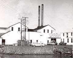
| 54 |
Union Fishermen's Cooperative Packing Company Alderbrook Station |
|
000000001991-02-20-0000February 20, 1991
(#91000053) |
4900 Ash St.
46°11′49″N 123°46′57″W / 46.19680556°N 123.7824889°W / 46.19680556; -123.7824889 (Union Fishermen's Cooperative Packing Company Alderbrook Station) |
Astoria |
|
| 55 |
Uniontown–Alameda Historic District |
|
000000001988-08-25-0000August 25, 1988
(#88001311) |
Marine Dr. and Alameda Ave., between Hume and Hull Aves.
46°11′18″N 123°50′54″W / 46.18836944°N 123.8484333°W / 46.18836944; -123.8484333 (Uniontown–Alameda Historic District) |
Astoria |
|
| 56 |
U.S. Post Office and Custom House |
|
000000001985-03-04-0000March 4, 1985
(#85000542) |
750 Commercial St.
46°11′21″N 123°50′07″W / 46.18929722°N 123.8352139°W / 46.18929722; -123.8352139 (U.S. Post Office and Custom House) |
Astoria |
|
| 57 |
Warren Investment Company Housing Group |
|
000000001986-06-05-0000June 5, 1986
(#86001223) |
656, 674, and 690 11th St.
46°11′11″N 123°49′54″W / 46.186475°N 123.831625°W / 46.186475; -123.831625 (Warren Investment Company Housing Group) |
Astoria |
|
| 58 |
Daniel Knight Warren House |
|
000000001988-09-08-0000September 8, 1988
(#88001521) |
107 NE Skipanon Dr.
46°10′06″N 123°55′19″W / 46.16846667°N 123.9219°W / 46.16846667; -123.9219 (Daniel Knight Warren House) |
Warrenton |
|
| 59 |
Oswald West Coastal Retreat |
|
000000001992-02-26-0000February 26, 1992
(#92000066) |
1981 Pacific Ave.
45°52′54″N 123°57′46″W / 45.881664°N 123.962762°W / 45.881664; -123.962762 (Oswald West Coastal Retreat) |
Cannon Beach |
|
| 60 |
Andrew Young House |
|
000000001986-06-26-0000June 26, 1986
(#86001391) |
3720 Duane St.
46°11′34″N 123°48′03″W / 46.192714°N 123.800835°W / 46.192714; -123.800835 (Andrew Young House) |
Astoria |
|
| 61 |
Benjamin Young House and Carriage House |
|
000000001979-03-07-0000March 7, 1979
(#79002047) |
3652 Duane St.
46°11′34″N 123°48′08″W / 46.192681°N 123.802350°W / 46.192681; -123.802350 (Benjamin Young House and Carriage House) |
Astoria |
|

 Media related to National Register of Historic Places in Clatsop County, Oregon at Wikimedia Commons
.jpg)
_in_2012.jpg)
_(clatDA0084).jpg)



%2C_2012.jpg)

_boarded-up%2C_2012.jpg)












_2.jpg)


_(clatDA0065a).jpg)


