National Register of Historic Places listings in Lincoln County, Oregon
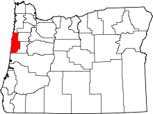
Location of Lincoln County in Oregon
This list presents the full set of buildings, structures, objects, sites, or districts designated on the National Register of Historic Places in Lincoln County, Oregon, and offers brief descriptive information about each of them. The National Register recognizes places of national, state, or local historic significance across the United States.[1] Out of over 90,000 National Register sites nationwide,[2] Oregon is home to over 2,000,[3] and 35 of those are found in Lincoln County.
- This National Park Service list is complete through NPS recent listings posted December 2, 2016.[4]
Current listings
| [5] | Name on the Register | Image | Date listed[6] | Location | City or town | Description |
|---|---|---|---|---|---|---|
| 1 | 35-LNC-76-The Ahnkuti Site |  |
(#01000133) |
Address restricted[7] |
Toledo | Oldest American Indian fish weir. |
| 2 | Archeological site 35LNC48 | Upload image | (#97001012) |
Address restricted[7] |
Yachats | |
| 3 | Archeological site 35LNC63 | Upload image | (#97001013) |
Address restricted[7] |
Yachats | |
| 4 | Archeological site 35LNC68 | Upload image | (#97001005) |
Address restricted[7] |
Depoe Bay | |
| 5 | Archeological Site No. 35-LNC-54 | Upload image | (#03001182) |
Address restricted[7] |
Yachats | |
| 6 | Archeological Site No. 35-LNC-55 | Upload image | (#03001183) |
Address restricted[7] |
Yachats | |
| 7 | Archeological Site No. 35-LNC-56 | Upload image | (#03001184) |
Address restricted[7] |
Yachats | |
| 8 | Archeological Site No. 35-LNC-57 | Upload image | (#03001185) |
Address restricted[7] |
Yachats | |
| 9 | Boiler Bay Site (35LNC45) | Upload image | (#97001003) |
Address restricted[7] |
Depoe Bay | |
| 10 | Cape Perpetua Shelter and Parapet |  |
(#88002016) |
3 miles (4.8 km) south of Yachats 44°17′14″N 124°06′30″W / 44.287222°N 124.108333°W |
Yachats | |
| 11 | Chitwood Bridge |  |
(#79002103) |
Off U.S. Route 20 44°39′08″N 123°48′58″W / 44.652222°N 123.816111°W |
Chitwood | |
| 12 | Depoe Bay Bridge No. 01388 | 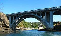 |
(#05000823) |
U.S. Route 101 (Oregon Coastal Highway 9) at milepost O127.61 44°48′36″N 124°03′39″W / 44.81°N 124.060833°W |
Depoe Bay | |
| 13 | Depoe Bay Ocean Wayside | |
(#12000082) |
119 SW US 101 44°48′36″N 124°03′44″W / 44.810073°N 124.062286°W |
Depoe Bay | |
| 14 | Devil's Punch Bowl |  |
(#97001006) |
Oregon coastline at Otter Rock[8] 44°44′50″N 124°03′53″W / 44.747251°N 124.06468°W |
Otter Rock | |
| 15 | Dorchester House | |
(#80003337) |
2701 U.S. Route 101 44°59′12″N 124°00′19″W / 44.986667°N 124.005278°W |
Lincoln City | |
| 16 | Fisher School Bridge | |
(#79002105) |
Five Rivers Rd. 44°17′33″N 123°50′23″W / 44.2925°N 123.839722°W |
Fisher | |
| 17 | Government Point Site | Upload image | (#97001002) |
Address restricted[7] |
Depoe Bay | |
| 18 | The Look-Out on Cape Foulweather | _(lincD0015).jpg) |
(#14001159) |
4905 Otter Crest Loop 44°45′38″N 124°04′00″W / 44.760571°N 124.066679°W |
Otter Rock vicinity | |
| 19 | New Cliff House | 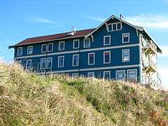 |
(#86002962) |
267 NW Cliff St. 44°38′18″N 124°03′40″W / 44.638333°N 124.061111°W |
Newport | |
| 20 | North 804 Midden (35LNC72) | Upload image | (#97001008) |
Address restricted[7] |
Yachats | |
| 21 | North Fork of the Yachats Bridge | 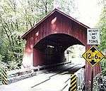 |
(#79002108) |
Northeast of Yachats 44°18′36″N 123°58′06″W / 44.31°N 123.968333°W |
Yachats | |
| 22 | Old Yaquina Bay Lighthouse |  |
(#74001692) |
Yaquina Bay State Park 44°37′27″N 124°03′44″W / 44.624167°N 124.062222°W |
Newport | |
| 23 | Pacific Spruce Saw Mill Tenant Houses |  |
(#99000602) |
146, 162, 178, and 192 NE 6th St. 44°37′31″N 123°56′14″W / 44.625278°N 123.937222°W |
Toledo | |
| 24 | Rocky Creek Bridge No. 01089 | 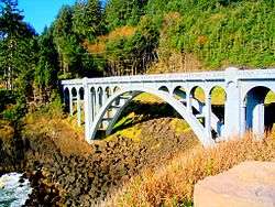 |
(#05000824) |
Otter Crest Loop Rd., U.S. Route 101 frontage road, at milepost F130.00 44°46′43″N 124°04′13″W / 44.778611°N 124.070278°W |
Otter Rock | |
| 25 | Rocky Creek Site (35LNC43) | Upload image | (#97001004) |
Address restricted[7] |
Depoe Bay | |
| 26 | Charles and Theresa Roper House |  |
(#81000500) |
620 SW Alder St. 44°38′00″N 124°03′28″W / 44.633333°N 124.057778°W |
Newport | |
| 27 | St. John's Episcopal Church | _(lincDA0044a).jpg) |
(#90001510) |
110 NE Alder St. 44°37′14″N 123°56′08″W / 44.620628°N 123.935665°W |
Toledo | |
| 28 | Seal Rock |  |
(#97001007) |
Address restricted[7] |
Seal Rock | |
| 29 | Siletz Agency Site | 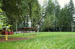 |
(#76001582) |
Siletz–Logsden Rd. 44°43′23″N 123°54′38″W / 44.723134°N 123.910587°W |
Siletz | Beginning in 1855, U.S. Army forcibly relocated over 2,600 people of several different tribes to the Siletz Reservation. The government established an Indian agency at Siletz in 1857. Within 30 years, hardship had reduced the Indian numbers to approximately 600. By the time the agency closed in 1925, "Government Hill" had grown to include a blockhouse, boarding house, schoolhouse, barn, office building, employee residences, hospital/meeting house, and cemetery, several of which have since been destroyed. The site remains a focal point for members of the Siletz tribes.[9] |
| 30 | Smelt Sands Midden (35LNC65) | Upload image | (#97001011) |
Address restricted[7] |
Yachats | |
| 31 | Trail 804 Midden #3 (35LNC73) | Upload image | (#97001009) |
Address restricted[7] |
Yachats | |
| 32 | US Spruce Production Railroad XII, Spur 5 | Upload image | (#88002032) |
East of Yachats 44°18′53″N 124°03′05″W / 44.314722°N 124.051389°W |
Yachats | |
| 33 | Yachats Trail 804 Midden (35LNC66) | Upload image | (#97001010) |
Address restricted[7] |
Yachats | |
| 34 | Yaquina Bay Bridge No. 01820 | 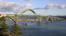 |
(#05000821) |
U.S. Route 101 (Oregon Coastal Highway 9) at milepost P141.67 44°37′23″N 124°03′21″W / 44.623056°N 124.055833°W |
Newport | |
| 35 | Yaquina Head Lighthouse |  |
(#73002340) |
Yaquina Head, about 4 miles (6.4 km) north of the entrance to the Yaquina River 44°40′37″N 124°04′41″W / 44.676944°N 124.078056°W |
Newport |
Former listings
| [5] | Name on the Register | Image | Date listed | Date removed | Location | City or town | Summary |
|---|---|---|---|---|---|---|---|
| 1 | Drift Creek Bridge | .jpg) |
(#79002106) | SE of Lincoln City |
Lincoln City vicinity | Original bridge dismantled in late 1997. | |
| 2 | Elk City Bridge | Upload image | (#79002104) | Cherry St. |
Elk City | Destroyed by a storm in 1981. | |
| 3 | Sam's Creek Bridge | Upload image | (#79002107) | E of Siletz |
Siletz vicinity | ||
| 4 | Tradewinds Kingfisher (cruiser) | _NRIS_91001562.jpg) |
(#91001562) | Depoe Bay Boat Basin 44°48′35″N 124°03′31″W / 44.809722°N 124.058611°W |
Depoe Bay | This vessel was demolished in December 5, 2013 due to an advanced state of deterioration. Parts of the vessel were saved for preservation and to exhibit at the Pacific Maritime & Heritage Center, Newport, Oregon.[10][11] |
See also
- National Register of Historic Places listings in Oregon
- Listings in neighboring counties: Benton, Lane, Polk, Tillamook
- Historic preservation
- History of Oregon
- Lists of Oregon-related topics
References
- ↑ Andrus, Patrick W.; Shrimpton, Rebecca H.; et al. (2002), How to Apply the National Register Criteria for Evaluation, National Register Bulletin (15), National Park Service, U.S. Department of the Interior, OCLC 39493977, archived from the original on April 6, 2014, retrieved June 20, 2014.
- ↑ National Park Service, National Register of Historic Places Program: Research, archived from the original on February 1, 2015, retrieved January 28, 2015.
- ↑ Oregon Parks and Recreation Department, Oregon Historic Sites Database, retrieved August 6, 2015. Note that a simple count of National Register records in this database returns a slightly higher total than actual listings, due to duplicate records. A close reading of detailed query results is necessary to arrive at the precise count.
- ↑ "National Register of Historic Places: Weekly List Actions". National Park Service, United States Department of the Interior. Retrieved on December 2, 2016.
- 1 2 Numbers represent an ordering by significant words. Various colorings, defined here, differentiate National Historic Landmarks and historic districts from other NRHP buildings, structures, sites or objects.
- ↑ The eight-digit number below each date is the number assigned to each location in the National Register Information System database, which can be viewed by clicking the number.
- 1 2 3 4 5 6 7 8 9 10 11 12 13 14 15 16 Federal and state laws and practices restrict general public access to information regarding the specific location of sensitive archeological sites in many instances. The main reasons for such restrictions include the potential for looting, vandalism, or trampling. See: Knoerl, John; Miller, Diane; Shrimpton, Rebecca H. (1990), Guidelines for Restricting Information about Historic and Prehistoric Resources, National Register Bulletin (29), National Park Service, U.S. Department of the Interior, OCLC 20706997.
- ↑ Location derived from this Oregon Parks and Recreation Department website; the NRIS lists it as "Address Restricted"
- ↑ Hartwig, Paul B.; Olson, Gregg (August 8, 1975), National Register of Historic Places Inventory — Nomination Form: Siletz Agency Site (PDF), retrieved March 17, 2013.
- ↑ "Bit of Oregon Coast History Demolished Due to Damage, Lack of Financial Support", BeachConnection.net, December 10, 2013, archived from the original on September 18, 2015, retrieved March 7, 2016.
- ↑ "Tradewinds Kingfisher sails into history", The News Guard, Lincoln City, OR, December 7, 2013.
External links
- Oregon Parks and Recreation Department, National Register Program
- National Park Service, National Register of Historic Places site
 Media related to National Register of Historic Places in Lincoln County, Oregon at Wikimedia Commons
This article is issued from Wikipedia - version of the 9/6/2016. The text is available under the Creative Commons Attribution/Share Alike but additional terms may apply for the media files.

