Raipur, Birbhum
| Raipur রায়পুর | |
|---|---|
| village | |
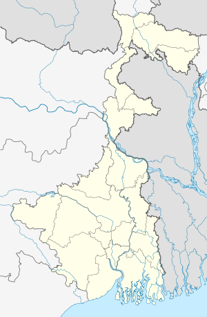 Raipur  Raipur Location in West Bengal, India | |
| Coordinates: 23°38′13″N 87°38′49″E / 23.636822°N 87.646872°ECoordinates: 23°38′13″N 87°38′49″E / 23.636822°N 87.646872°E | |
| Country | India |
| State | West Bengal |
| District | Birbhum |
| Government | |
| • Type | Panchayati raj (India) |
| • Body | Gram panchayat |
| Population (2001) | |
| • Total | 2,063 |
| Languages | |
| • Official | Bengali, English |
| Time zone | IST (UTC+5:30) |
| Vehicle registration | WB |
| Lok Sabha constituency | Bolpur |
| Vidhan Sabha constituency | Bolpur |
| Website |
birbhum |
- For other places with the same name see Raipur (disambiguation)
Raipur is a village under Raipur–Supur gram panchayat of Bolpur–Sriniketan block in Bolpur subdivision of Birbhum district in the Indian state of West Bengal.[1]
Geography
Raipur is located at 23°38′13″N 87°38′49″E / 23.636822°N 87.646872°E. The village lies on the road that bypasses the town of bolpur and is near to the BITM.
History
In 1863, Debendranath Tagore took on permanent lease 20 acres (81,000 m2) of land, with two chhatim trees, at a yearly payment of Rs. 5, from Bhuban Mohan Singha, the talukdar of Raipur. He built a guest house and named it Santiniketan (the abode of peace). Gradually, the whole area came to be known as Santiniketan.[2]
Satyendra Prasanno Sinha, a subsequent talukdar of Raipur, was elevated to the peerage as Baron Sinha, of Raipur, in 1919, becoming the first Indian member of the British House of Lords,
Demographics
Raipur has an area of 37 ha and a population of 2063, of which 987 belong to scheduled castes and 149 to scheduled tribes.[1]
Tourist Interest
The ruins of the ancestral house of Bhuban Mohan Singha still stands at the end of the village. Tourists bound for Surul Sriniketan Santiniketan may easily pay a visit to this site. The grandeur and vast expanse of the once stately mansion can still be recognized. Raipur is also on the banks of River Ajay and visitors may also enjoy the beauty of this grand river.
References
- 1 2 "Census Data District Name: Birbhum(08) Block Name: Bolpur-Sriniketan (0016)" (PDF). Government of West Bengal. Retrieved 2009-04-03.
- ↑ Basak, Tapan Kumar, Rabindranath-Santiniketan-Sriniketan (An Introduction), p. 2, B.B.Publication
Cities, towns and locations in Birbhum district | |||||||||||
|---|---|---|---|---|---|---|---|---|---|---|---|
| Cities, municipal and census towns |
| ||||||||||
| Locations other than cities and towns | |||||||||||
| See also |
| ||||||||||