Scarboro, Calgary
| Scarboro | |
|---|---|
| Neighbourhood | |
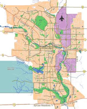
 Scarboro Location of Scarboro in Calgary | |
| Coordinates: 51°02′20″N 114°06′29″W / 51.03889°N 114.10806°WCoordinates: 51°02′20″N 114°06′29″W / 51.03889°N 114.10806°W | |
| Country |
|
| Province |
|
| City |
|
| Quadrant | SW |
| Ward | 8 |
| Established | 1910 |
| Government[1] | |
| • Mayor | Naheed Nenshi |
| • Administrative body | Calgary City Council |
| • Councillor | Evan Woolley |
| Elevation | 1,085 m (3,560 ft) |
| Population (2006)[2] | |
| • Total | 1,328 |
| • Average Income | $79,948 |
| Postal code | T3C |
| Website | Scarboro Community Association |
Scarboro is a residential neighbourhood in the south-west quadrant of Calgary, Alberta. It is located in the inner city, between Bow Trail, 24th Street West and 14th St West. Its north-south boundaries are 12th Avenue South and 17th Avenue South. The community is bisected by the Crowchild Trail freeway.
The community consists of Scarboro proper, located on Scarboro Hill, consisting mostly of detached homes, and Upper Scarboro (officially called Scarboro/Sunalta West[3]) which consists of the remaining small residential area west of Crowchild Trail.
Demographics
In the City of Calgary's 2012 municipal census, Scarboro had a population of 880 living in 343 dwellings, a 1.1% increase from its 2011 population of 870.[4] With a land area of 0.5 km2 (0.19 sq mi), it had a population density of 1,760/km2 (4,600/sq mi) in 2012.[4][5] Also in the 2012 municipal census, Scarboro/Sunalta West had a population of 410 living in 165 dwellings, a 3.3% increase from its 2011 population of 397.[4] With a land area of 0.4 km2 (0.15 sq mi), it had a population density of 1,030/km2 (2,700/sq mi) in 2012.[4][5]
It is represented in the Calgary City Council by the Ward 8 councillor,[1] on a provincial level by Calgary-Buffalo MLA Kent Hehr, and at federal level by Calgary Centre MP Joan Crockatt.
Scarboro is a well established and relatively wealthy neighbourhood, with the median household income of $79,948 (2000), and 7.5% low-income residents.[6] As of 2000, 20.6% of the residents were immigrants. While the City of Calgary profile on Scarboro details a proportion of 27.3% of the buildings were condominiums or apartments, and 29.5% of the housing was used for renting, the actual neighbourhood consists of approximately 365 single-family dwellings. All are zoned R-1 and there are no multifamily residences or condominiums or apartments within Scarboro.[2]
Education
The community is served by Sunalta Elementary public school and Sacred Heart Elementary (also publicly funded.)
See also
References
- 1 2 "Calgary Elections". City of Calgary. October 21, 2013. Retrieved October 22, 2013.
- 1 2 City of Calgary (2006). "Scarboro Community Statistics" (PDF). Retrieved 2007-05-09.
- ↑ City of Calgary (2006). "Scarboro/Sunalta West Community Statistics" (PDF). Retrieved 2007-05-09.
- 1 2 3 4 "2012 Civic Census Results" (PDF). City of Calgary. 2012. Retrieved February 4, 2013.
- 1 2 "Community Boundaries" (Esri shapefile). City of Calgary. Retrieved February 5, 2013.
- ↑ City of Calgary (2004). "Ward 8 Profile" (PDF). Retrieved 2007-05-09.
 |
Bow River | Sunalta | Downtown |  |
| Shaganappi (Crowchild Trail) | |
Beltline | ||
| ||||
| | ||||
| Richmond | Bankview | Mount Royal |