Fort Irwin National Training Center
| Fort Irwin National Training Center | |
|---|---|
| San Bernardino County, California | |
|
NTC Shoulder Sleeve Insignia | |
|
Aerial view of Fort Irwin | |
| Type | Training Center |
| Site information | |
| Owner | United States Army |
| Controlled by | US Army Forces Command |
| Condition | In use |
| Site history | |
| Built | 1940 |
| In use |
1940–1942; 1951–1972; 1980–present. |
| Garrison information | |
| Current commander |
BG Jeffery D. Broadwater COL G. Scott Taylor (Garrison commander) |
| Occupants |
1942-08-14 – 1942-10-20 7th Infantry Division |
| Fort Irwin | |
|---|---|
| census-designated place | |
 Fort Irwin Position in California. | |
| Coordinates: 35°14′47″N 116°40′55″W / 35.24639°N 116.68194°WCoordinates: 35°14′47″N 116°40′55″W / 35.24639°N 116.68194°W | |
| Country | United States |
| State |
|
| County | San Bernardino |
| Area[1] | |
| • Total | 7.053 sq mi (18.267 km2) |
| • Land | 7.053 sq mi (18.267 km2) |
| • Water | 0 sq mi (0 km2) 0% |
| Elevation[2] | 2,454 ft (748 m) |
| Population (2010) | |
| • Total | 8,845 |
| • Density | 1,300/sq mi (480/km2) |
| Time zone | Pacific (PST) (UTC-8) |
| • Summer (DST) | PDT (UTC-7) |
| ZIP Code | 92310 |
| Area codes | 442/760 |
| GNIS feature ID | 2628733 |
| U.S. Geological Survey Geographic Names Information System: Fort Irwin CDP | |
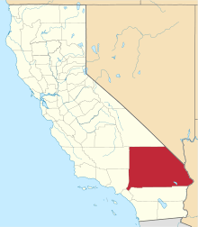
Fort Irwin National Training Center is a major training area for the United States Military and is a census-designated place located in the Mojave Desert in northern San Bernardino County, California. Fort Irwin is at an average elevation of 2,454 feet (748 m).[2] It is located 37 miles (60 km) northeast of Barstow, in the Calico Mountains.
The National Training Center is part of the US Army Forces Command (FORSCOM). The opposing force at the National Training Center (NTC) is the 11th Armored Cavalry Regiment, the Blackhorse Cavalry, who are stationed at the base to provide an opposing force to units on a training rotation at Fort Irwin.
Fort Irwin works within the R-2508 Special Use Airspace Complex.
The 2010 United States census reported Fort Irwin's population was 8,845.
History
The Fort Irwin area has a history dating back almost 15,000 years, when Native Americans of the Lake Mojave Period were believed to live in the area. Native American settlements and pioneer explorations in the area were first recorded when Father Francisco Garces, a Spaniard, traveled the Mojave Indian Trail in 1796. During his travels, he noted several small bands of Indians and is believed to have been the first European to make contact with the Native Americans of this area.
Jedediah Smith is thought to have been the first American to explore the area in 1826. A fur trapper, Smith was soon followed by other pioneers traveling the Old Spanish Trail between Santa Fe and Los Angeles. Bitter Springs, on the eastern edge of Fort Irwin, was a favorite stop over site.
In 1844, Captain John C. Fremont, accompanied by Kit Carson, was the first member of the US Army to visit the Fort Irwin area. Captain Fremont established a camp near Bitter Springs that served travelers on the Old Spanish Trail, and later the Mormon Trail, linking Salt Lake City to California. This camp was later to become an important supply center for pioneers during California's settlement and gold rush.
The California Gold Rush brought prosperous trade and unexpected trouble to the area. As California grew, and more travelers used the trails to enter the territory, raids and horse stealing became a problem. In 1846, the Army's Mormon Battalion patrolled the Fort Irwin area to control the raiding and horse stealing. During the Indian Wars the Army constructed a small stone fort overlooking Bitter Springs and patrolled the Fort Irwin area.

In the 1880s the area experienced an economic boom with the discovery of borax at Death Valley. From the late 19th century to the early 20th century, the area began to grow tremendously as mining operations of all types flourished. Soon railroads, workers, and businesses led to the establishment of the nearby town of Barstow.
The years following the Indian Wars were quiet militarily. In 1940, President Franklin D. Roosevelt established the Mojave Anti-Aircraft Range, a military reservation of approximately 1,000 square miles (3,000 km2) in the area of the present Fort Irwin. In 1942, the Mojave Anti-Aircraft Range was renamed Camp Irwin, in honor of Major General George LeRoy Irwin, commander of the 57th Field Artillery Brigade during World War I, and it was subsumed into the Desert Training Center as one of its cantonment areas and some of its ranges. Two years later, Camp Irwin was deactivated and placed on surplus status.
Camp Irwin reopened its gates in 1951 as the Armored Combat Training Area and served as a training center for combat units during the Korean War. Regimental tank companies of the U.S. 43d Infantry Division from Camp Pickett, Virginia were the first to train at the new facility.
The post was designated a permanent installation on 1 August 1961 and renamed Fort Irwin. During the Vietnam buildup, many units, primarily artillery and engineer, trained and deployed from Fort Irwin.
In January 1971, the post was deactivated again and placed in maintenance status under the control of Fort MacArthur (Los Angeles), California. The California National Guard assumed full responsibility for the post in 1972. From 1972 to late 1980, Fort Irwin was used primarily as a training area by the Army National Guard and U.S. Army Reserve.
National Training Center


On 9 August 1979, the Department of the Army announced that Fort Irwin had been selected as the site for the National Training Center. With over 1,000 square miles (2,600 km2) for maneuver and ranges, an uncluttered electromagnetic spectrum, airspace restricted to military use, and its isolation from densely populated areas, Fort Irwin was an ideal site for this facility. The National Training Center was officially activated 16 October 1980, and Fort Irwin was transferred from the California Army National Guard back to the Regular Army and returned to active status on 1 July 1981.
Since its activation, the National Training Center has witnessed many firsts. The first units to train against the Opposing Force (OPFOR) at the NTC were from among others the 3rd Battalion 67th Armor 2nd Armored Division from Fort Hood Texas operation named TASK FORCE IRWIN III, 1 Aug - 14 Sept 1979.. 3rd Brigade, U.S. 1st Cavalry Division from Fort Hood Texas. in spring 1981. Also Ft Irwin and the 1st CAV tested and implemented the M.I.L.E.S., Multiple Integrated Laser Engagement System. Infantry and armor units first augmented the Opposing Force in 1984 as a detachment of the 7th infantry Division, Fort Ord CA. June 1985 saw the first use of M1 Abrams tanks and later in the fall of 1985 saw the M2 Bradley fighting vehicles on the National Training Center battlefield. The first armored cavalry squadron rotation occurred in November 1984. Units from the 101st Airborne Division participated in the first light force rotation in March 1985. The 197th Infantry Brigade participated in the first extended rotation with brigade operations in June 1985. The first combined Light/Mechanized Infantry rotation took place in February 1990; the 7th Infantry Division (Light) from Fort Ord and the 24th Infantry Division (Mechanized) from Fort Stewart, Georgia participated. The first MOUT (Military Operations in Urban Terrain) mission was conducted at the National Training Center Pioneer Training Facility in December 1993.
OPFOR
During the re-opening of the National Training Center in 1980, the OPFOR consisted of a detachment of infantry from the 7th Infantry Division US Army based in Fort Ord, California, and the 1st Bn, 73rd Armor. Once the US Army turned to regimental units in 1985, the OPFOR was designated the 177th Armored Brigade (SEP). The OPFOR soldiers wore Soviet-style armor uniforms including black berets and Soviet-style insignias, and used M551 Sheridan tanks visually modified to resemble BMP-1 vehicles and T-72 tanks. Units from the U.S. Marine Corps (USMC) and the U.S. Army Reserve and Army National Guard would support infantry roles for the OPFOR.
Air support and air combat tactics came from USAF tactical fighter wings operating from nearby Nellis AFB and George AFB, USN attack and strike fighter jet squadrons from NAS Lemoore, USMC attack and fighter/attack jet squadrons operating from MCAS El Toro, and USMC helicopter light attack squadrons operating from MCAS Tustin. When George AFB, MCAS El Toro and MCAS Tustin were closed as a result of Base Realignment and Closure Commission actions in the mid-1990s, USAF air support shifted to a combination of composite wings and fighter wings from Nellis AFB, Hill AFB, Luke AFB and Davis-Monthan AFB, and USMC air support shifted to MCAS Miramar (formerly NAS Miramar), MCAS Yuma and MCAS Camp Pendleton.
During the 1980s and 1990s, the National Training Center also showcased U.S. Army large-scale tactics to foreign military leaders from all over the world. The OPFOR ran 15 training rotations a year against armored brigades from Active Component and Reserve Component U.S. Army units from all over the United States. The command centers of the large-scale battles were computerized in a central command post, where each battle was recorded, analyzed, and the results subsequently debriefed to participants.
The NTC Today
The National Training Center and Fort Irwin continues to serve as the Army's premier training center. After the September 11, 2001 attacks, the National Training Center transformed to focus on continuous counterinsurgency operations that reflected an ongoing and rapidly changing battlefield, especially in African/Middle Eastern/Southwest Asian-focused desert environments.
NTC rotations incorporate a complex scenario design laden with social, ethical and moral dilemmas; the goal of which is to develop leaders while exposing them to multifaceted problems. Units training at the NTC today face a complex hybrid threat. Units must face a near-peer opposing force, while taking on an insurgent force. At the same time, they must assist the local towns and villages in any way possible.
The training uses simulated Unmanned Aircraft System (UAS), live UAS, an instrumentation system (MILES) and incorporates joint enablers, multi-national forces, Inter-agency Integration, media and social media reports.
Observer, Controller and Trainers (OCTs) are embedded with the training units down to Platoon Level.
Some of the villages are completely instrumented, including video recording, to assist the OC/T teams in providing feedback to the rotational training unit
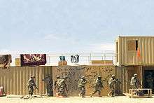
One of the features of the base is the presence of 12 mock "villages" which are used to train troops in Military Operations in Urban Terrain (MOUT) prior to their deployment. The villages mimic real villages and have variety of buildings such as religious sites, hotels, traffic circles, etc. filled with foreign language speaking actors portraying government officials, local police, local military, villagers, street vendors, and insurgents. The largest two are known as Razish and Ujen, the closest located about 30 minutes from the main part of the post. Most of the buildings are created using intermodal containers, stacked to create larger structures, the largest village consists of 585 buildings that can engage an entire brigade combat team into a fight.
All of the military services train at the National Training Center, as well as other government agencies, and foreign military units.
It is a common tradition for any military unit visiting the installation to paint a design on one of the large rock formations near the main gate. Units of all types and locations are represented.
Fort Irwin Solar Project
Fort Irwin Solar Project will be the largest renewable energy project in the Department of Defense's history. The initial development plan is expected to result in more than 500 MW of renewable energy with one billion kilowatt-hours (kWh) of solar power generated per year by 2022. The $2-billion Fort Irwin Solar Project will create jobs both during construction and long-term plant operations, as well as generate additional revenue for local businesses.[3]
Geography
Fort Irwin has a total area of 2,579.77 km² (996.055 sq mi), with only 0.3277 km² of this area as water, according to the United States Census Bureau, however the CDP covers an area of 7.1 square miles (18.3 km²), all of it land.
Within its territory on its western side lies the Goldstone Deep Space Communications Complex. The ZIP Code is 92310 and the reservation is inside area codes 442 and 760.
Climate
| Climate data for Bicycle Lake AAF Elev: 2,350ft (1982,1986,1991-1998,2006,2010-2014 normals) | |||||||||||||
|---|---|---|---|---|---|---|---|---|---|---|---|---|---|
| Month | Jan | Feb | Mar | Apr | May | Jun | Jul | Aug | Sep | Oct | Nov | Dec | Year |
| Record high °F (°C) | 77 (25) |
86 (30) |
91 (33) |
96 (36) |
107 (42) |
113 (45) |
113 (45) |
114 (46) |
106 (41) |
102 (39) |
86 (30) |
74 (23) |
114 (46) |
| Average high °F (°C) | 58 (14) |
62 (17) |
69 (21) |
76 (24) |
83 (28) |
95 (35) |
100 (38) |
99 (37) |
93 (34) |
79 (26) |
65 (18) |
57 (14) |
78 (26) |
| Average low °F (°C) | 42 (6) |
43 (6) |
49 (9) |
53 (12) |
59 (15) |
69 (21) |
76 (24) |
76 (24) |
71 (22) |
59 (15) |
49 (9) |
42 (6) |
58 (14) |
| Record low °F (°C) | 20 (−7) |
18 (−8) |
30 (−1) |
35 (2) |
42 (6) |
46 (8) |
46 (8) |
46 (8) |
44 (7) |
31 (−1) |
7 (−14) |
18 (−8) |
7 (−14) |
| Source: AFCCC (extremes 1982,1986,1991-1998,2006,2010-2014)[4] | |||||||||||||
Demographics
The 2010 United States Census[5] reported that the Fort Irwin Census Designated Place had a population of 8,845. The population density was 1,254.1 people per square mile (484.2/km²). The racial makeup of Fort Irwin was 5,481 (62.0%) White (51.6% Non-Hispanic White),[6] 1,086 (12.3%) African American, 103 (1.2%) Native American, 402 (4.5%) Asian, 120 (1.4%) Pacific Islander, 916 (10.4%) from other races, and 737 (8.3%) from two or more races. Hispanic or Latino of any race were 2,261 persons (25.6%).
The Census reported that 7,507 people (84.9% of the population) lived in households, 1,338 (15.1%) lived in non-institutionalized group quarters, and 0 (0%) were institutionalized.
There were 2,371 households, out of which 1,532 (64.6%) had children under the age of 18 living in them, 1,903 (80.3%) were opposite-sex married couples living together, 133 (5.6%) had a female householder with no husband present, 54 (2.3%) had a male householder with no wife present. There were 13 (0.5%) unmarried opposite-sex partnerships, and 15 (0.6%) same-sex married couples or partnerships. 244 households (10.3%) were made up of individuals and 3 (0.1%) had someone living alone who was 65 years of age or older. The average household size was 3.17. There were 2,090 families (88.1% of all households); the average family size was 3.41.
The population was spread out with 2,992 people (33.8%) under the age of 18, 1,888 people (21.3%) aged 18 to 24, 3,727 people (42.1%) aged 25 to 44, 224 people (2.5%) aged 45 to 64, and 14 people (0.2%) who were 65 years of age or older. The median age was 23.9 years. For every 100 females there were 132.1 males. For every 100 females age 18 and over, there were 147.9 males.
There were 2,487 housing units at an average density of 352.6 per square mile (136.1/km²), of which 18 (0.8%) were owner-occupied, and 2,353 (99.2%) were occupied by renters. The homeowner vacancy rate was 0%; the rental vacancy rate was 4.3%. 71 people (0.8% of the population) lived in owner-occupied housing units and 7,436 people (84.1%) lived in rental housing units.
According to the 2010 United States Census, Fort Irwin had a median household income of $50,469, with 12.6% of the population living below the federal poverty line.[6]
Others
- Some scenes of 1979 Miloš Formans musical war comedy-drama Hair are filmed here.
- The remains of the Epsom Salts Monorail are close by.
See also
Climate
According to the Köppen Climate Classification system, Fort Irwin has a cold desert climates, abbreviated "BWk" on climate maps.[7]
References
- ↑ "2010 Census U.S. Gazetteer Files – Places – California". United States Census Bureau.
- 1 2 U.S. Geological Survey Geographic Names Information System: Fort Irwin National Training Center
- ↑ US Army Corps. "Fort Irwin" (PDF).
- ↑ "AFCCC Operational Climate Data Summary". 14WS Air Force Combat Climatological Center. Retrieved 2014-08-22.
- ↑ "2010 Census Interactive Population Search: CA - Fort Irwin CDP". U.S. Census Bureau. Retrieved July 12, 2014.
- 1 2 "Fort Irwin CDP QuickFacts". United States Census Bureau.
- ↑ Climate Summary for Fort Irwin
External links
| Wikimedia Commons has media related to Fort Irwin Military Reservation. |
- Fort Irwin Homepage
- GlobalSecurity.org article
- 'Fighting insurgents in Baghdad USA' The Sunday Times. 2008-10-5. Retrieved on 2009-02-16


