Fayette Junction, Arkansas
| Fayette Junction, Arkansas | |
|---|---|
| Unincorporated community | |
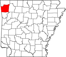
 Fayette Junction, Arkansas Fayette Junction's position in Arkansas. | |
| Coordinates: 36°2′30″N 94°10′50″W / 36.04167°N 94.18056°WCoordinates: 36°2′30″N 94°10′50″W / 36.04167°N 94.18056°W | |
| Country |
|
| State |
|
| County | Washington |
| Township | Fayetteville |
| Elevation[1] | 378 m (1,240 ft) |
| Time zone | Central (CST) (UTC-6) |
| • Summer (DST) | CDT (UTC-5) |
| ZIP code | 72701 |
| Area code(s) | 479 |
| GNIS feature ID | 81858 |
| U.S. Geological Survey Geographic Names Information System: Fayette Junction, Arkansas | |
Fayette Junction is an unincorporated community in Fayetteville Township, Washington County, Arkansas, United States.[2] It is located in south Fayetteville near the intersection of Razorback Road and Cato Springs Road.[3]
The St. Louis – San Francisco Railway tracks running from Missouri to Texas intersected a short line railroad from St. Paul, Arkansas south of Fayetteville. This junction became known as Fayette Junction. Today the short line no longer exists, and Fayette Junction is within the city limits of Fayetteville.
References
- ↑ "Fayette Junction, Arkansas". Histopolis. Retrieved 3 August 2011.
- ↑ U.S. Geological Survey Geographic Names Information System: Fayette Junction, Arkansas United States Geological Survey. Retrieved 3 August 2011.
- ↑ Arkansas Atlas and Gazetteer (Map) (Second ed.). DeLorme. § 22.
This article is issued from Wikipedia - version of the 2/10/2014. The text is available under the Creative Commons Attribution/Share Alike but additional terms may apply for the media files.