Seròs
| Seròs | ||
|---|---|---|
| Municipality | ||
.jpg) | ||
| ||
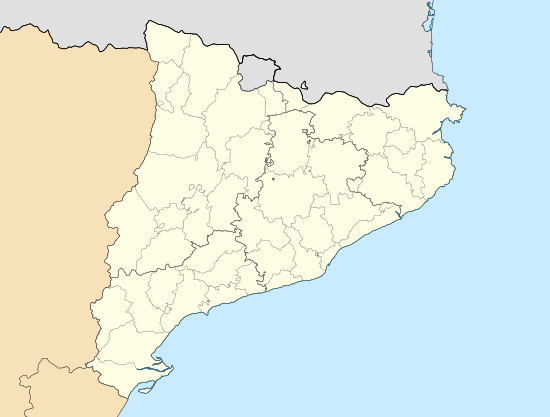
 Seròs Location in Catalonia | ||
| Coordinates: 41°27′55″N 0°24′42″E / 41.46528°N 0.41167°ECoordinates: 41°27′55″N 0°24′42″E / 41.46528°N 0.41167°E | ||
| Province | Lleida | |
| Comarca | Segrià | |
| Government | ||
| • Mayor | Gabriel Pena Remolà (2015)[1] | |
| Area[2] | ||
| • Total | 85.8 km2 (33.1 sq mi) | |
| Elevation | 102 m (335 ft) | |
| Population (2014)[1] | ||
| • Total | 1,887 | |
| • Density | 22/km2 (57/sq mi) | |
| Demonym(s) |
Seronenc, seronenca Serossà, serossana | |
| Website |
seros | |
Seròs (Catalan pronunciation: [səˈɾɔs], locally: [seˈɾɔs]) is a municipality in the comarca of the Segrià in Catalonia, Spain. It is situated on the right bank of the Segre river in the south-west of the comarca. The Aragon and Catalonia canal provides irrigation water for growing fruit. The municipality is linked to the rest of the comarca and to Fraga (comarca of Baix Cinca, Aragon) by the C-242 road.
Demography
| 1900 | 1930 | 1950 | 1970 | 1986 | 2007 |
|---|---|---|---|---|---|
| 779 | 878 | 1030 | 976 | 871 | 1893 |
See also
References
- 1 2 "Ajuntament de Seròs". Generalitat of Catalonia. Retrieved 2015-11-13.
- ↑ "El municipi en xifres: Seròs". Statistical Institute of Catalonia. Retrieved 2015-11-23.
- Panareda Clopés, Josep Maria; Rios Calvet, Jaume; Rabella Vives, Josep Maria (1989). Guia de Catalunya, Barcelona:Caixa de Catalunya. ISBN 84-87135-01-3 (Spanish). ISBN 84-87135-02-1 (Catalan).
External links
- Official website (Catalan)
- Information - Generalitat de Catalunya (Catalan)
- Statistical information - Institut d'Estadística de Catalunya (Catalan)
 |
Massalcoreig | Fraga (Aragon) | Aitona |  |
| La Granja d'Escarp | |
Llardecans | ||
| ||||
| | ||||
| Mequinenza (Aragon) | Almatret | Maials |
This article is issued from Wikipedia - version of the 1/25/2016. The text is available under the Creative Commons Attribution/Share Alike but additional terms may apply for the media files.

