| [8] |
Landmark name |
Image |
Date designated[9] |
Location |
County |
Description |
|---|
| 1 |
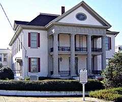
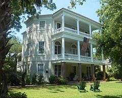
William Aiken House and Associated Railroad Structures |
|
000000001963-11-04-0000November 4, 1963
(#66000698) |
Charleston
32°47′21″N 79°56′15″W / 32.789167°N 79.9375°W / 32.789167; -79.9375 (William Aiken House and Associated Railroad Structures) |
Charleston |
Structures of South Carolina Canal and Railroad Company, the longest operating railroad in the world in 1833, and home of founder William Aiken
|
| 2 |
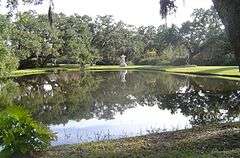
Atalaya and Brookgreen Gardens |
|
000000001992-10-05-0000October 5, 1992
(#84002045) |
Murrells Inlet
33°30′50″N 79°05′07″W / 33.513889°N 79.085278°W / 33.513889; -79.085278 (Atalaya and Brookgreen Gardens) |
Georgetown |
Landmark combining Atalaya and portions of Brookgreen Gardens associated with artist Anna Hyatt Huntington
|
| 3 |
Beaufort Historic District |
|
000000001973-11-07-0000November 7, 1973
(#69000159) |
Beaufort
32°26′08″N 80°40′04″W / 32.435556°N 80.667778°W / 32.435556; -80.667778 (Beaufort Historic District) |
Beaufort |
|
| 4 |
Bethesda Presbyterian Church |
|
000000001985-02-04-0000February 4, 1985
(#85003258) |
Camden
34°14′48″N 80°36′19″W / 34.246589°N 80.605213°W / 34.246589; -80.605213 (Bethesda Presbyterian Church) |
Kershaw |
Church designed by Robert Mills
|
| 5 |
William Blacklock House |
|
000000001973-11-07-0000November 7, 1973
(#73001681) |
Charleston
32°46′59″N 79°56′22″W / 32.782927°N 79.939353°W / 32.782927; -79.939353 (William Blacklock House) |
Charleston |
Adamesque house, possibly designed by Gabriel Manigault
|
| 6 |
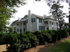
Borough House |
|
000000001988-06-07-0000June 7, 1988
(#72001224) |
Stateburg
33°57′14″N 80°32′16″W / 33.953889°N 80.537778°W / 33.953889; -80.537778 (Borough House) |
Sumter |
"The oldest and largest collection of 'high style' pise de terre (rammed earth) buildings in the United States". Across the road from Church of the Holy Cross
|
| 7 |
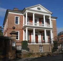
Miles Brewton House |
|
000000001960-10-09-0000October 9, 1960
(#66000699) |
Charleston
32°46′20″N 79°55′56″W / 32.772131°N 79.932201°W / 32.772131; -79.932201 (Miles Brewton House) |
Charleston |
Fine examples of a "double house" (having four main rooms per floor) in Charleston
|
| 8 |
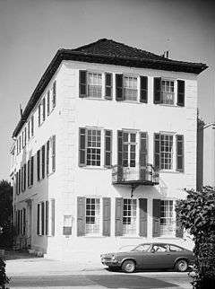
Robert Brewton House |
|
000000001960-10-09-0000October 9, 1960
(#66000700) |
Charleston
32°46′28″N 79°55′45″W / 32.774388°N 79.929041°W / 32.774388; -79.929041 (Robert Brewton House) |
Charleston |
Charleston's oldest dated "single" house (one room wide, with the narrow end toward the street, and entry centered in long side)
|
| 9 |
Brick House Ruins |
|
000000001970-04-15-0000April 15, 1970
(#70000580) |
Edisto Island
32°35′59″N 80°19′32″W / 32.599774°N 80.325420°W / 32.599774; -80.325420 (Brick House Ruins) |
Charleston |
Ruins of a plantation house that burned in 1929
|
| 10 |
Burt-Stark Mansion |
|
000000001992-10-05-0000October 5, 1992
(#70000559) |
Abbeville
34°10′49″N 82°22′55″W / 34.180317°N 82.382023°W / 34.180317; -82.382023 (Burt-Stark Mansion) |
Abbeville |
Where the American Civil War ended.
|
| 11 |
Camden Battlefield |
|
000000001961-01-20-0000January 20, 1961
(#66000707) |
Camden
34°20′47″N 80°36′27″W / 34.346389°N 80.6075°W / 34.346389; -80.6075 (Camden Battlefield) |
Kershaw |
Site of Battle of Camden, British victory in 1780
|
| 12 |
Chapelle Administration Building |
|
000000001976-12-08-0000December 8, 1976
(#76001710) |
Columbia
34°00′37″N 81°01′15″W / 34.010263°N 81.020966°W / 34.010263; -81.020966 (Chapelle Administration Building) |
Richland |
Allen University building designed by John A. Lankford, "dean of black architecture"
|
| 13 |
Charlesfort-Santa Elena Site |
|
000000002001-01-03-0000January 3, 2001
(#74001822) |
Parris Island
32°18′23″N 80°40′32″W / 32.306389°N 80.675556°W / 32.306389; -80.675556 (Charlesfort-Santa Elena Site) |
Beaufort |
Archeological site of French fort built in 1562 and Spanish forts built in 1566 and after.
|
| 14 |
Charleston Historic District |
|
000000001960-10-09-0000October 9, 1960
(#78002497) |
Charleston
32°47′08″N 79°56′13″W / 32.785556°N 79.936944°W / 32.785556; -79.936944 (Charleston Historic District) |
Charleston |
Historic district including 81 contributing properties and 700 others.
|
| 15 |
Church of the Holy Cross |
|
000000001973-11-07-0000November 7, 1973
(#73001732) |
Stateburg
33°57′39″N 80°31′55″W / 33.960744°N 80.531944°W / 33.960744; -80.531944 (Church of the Holy Cross) |
Sumter |
Gothic Revival Church constructed of rammed earth in 1852. Across the road from Borough House
|
| 16 |
USS Clamagore |
|
000000001989-06-29-0000June 29, 1989
(#89001229) |
Mount Pleasant
32°47′16″N 79°54′28″W / 32.787883°N 79.907744°W / 32.787883; -79.907744 (USS Clamagore) |
Charleston |
A submarine that was in training when World War II ended
|
| 17 |
Coker Experimental Farms |
|
000000001964-07-19-0000July 19, 1964
(#66000706) |
Hartsville
34°21′47″N 80°03′35″W / 34.363056°N 80.059722°W / 34.363056; -80.059722 (Coker Experimental Farms) |
Darlington |
Site of crop-improvement experiments that "played a great role in the agricultural revolution of the South"
|
| 18 |
College of Charleston |
|
000000001971-11-11-0000November 11, 1971
(#71000748) |
Charleston
32°47′03″N 79°56′17″W / 32.784167°N 79.938056°W / 32.784167; -79.938056 (College of Charleston) |
Charleston |
Historic and attractive campus center; Randolph Hall, Towell Library, and Gate Lodge completed by 1856, designed by William Strickland, Edward Brickell White, and George E. Walker
|
| 19 |
Drayton Hall |
|
000000001960-10-09-0000October 9, 1960
(#66000701) |
Charleston
32°52′15″N 80°04′35″W / 32.8709°N 80.0763°W / 32.8709; -80.0763 (Drayton Hall) |
Charleston |
Plantation house built in 1742 of Palladian architectural style
|
| 20 |
Exchange and Provost |
|
000000001973-11-07-0000November 7, 1973
(#69000160) |
Charleston
32°46′37″N 79°55′37″W / 32.776842°N 79.927009°W / 32.776842; -79.927009 (Exchange and Provost) |
Charleston |
Variously a customhouse, mercantile exchange, military prison and barracks, post office, and meeting place of the 1790 State Legislature
|
| 21 |
Farmers' and Exchange Bank |
|
000000001973-11-07-0000November 7, 1973
(#73001685) |
Charleston
32°46′39″N 79°55′37″W / 32.777435°N 79.926964°W / 32.777435; -79.926964 (Farmers' and Exchange Bank) |
Charleston |
A unique Moorish-style bank building built in 1854
|
| 22 |
Fig Island |
Upload image |
000000002007-03-29-0000March 29, 2007
(#70000585) |
Charleston
32°34′13″N 80°12′55″W / 32.5703°N 80.2153°W / 32.5703; -80.2153 (Fig Island) |
Charleston |
Archaeological site that is "one of the most complex shell-ring sites" in the United States
|
| 23 |
Fireproof Building |
|
000000001969-11-07-0000November 7, 1969
(#69000161) |
Charleston
32°46′37″N 79°55′52″W / 32.776923°N 79.931052°W / 32.776923; -79.931052 (Fireproof Building) |
Charleston |
Designed by Robert Mills to be the most fireproof building in America; now the South Carolina Historical Society building.
|
| 24 |
First Baptist Church |
|
000000001973-11-07-0000November 7, 1973
(#71000800) |
Columbia
34°00′21″N 81°02′00″W / 34.005864°N 81.033450°W / 34.005864; -81.033450 (First Baptist Church) |
Richland |
Where the American Civil War started, with the secession of South Carolina from the Union.
|
| 25 |
Fort Hill (John C. Calhoun House) |
|
000000001960-12-19-0000December 19, 1960
(#66000708) |
Clemson
34°40′34″N 82°50′21″W / 34.675976°N 82.839208°W / 34.675976; -82.839208 (Fort Hill (John C. Calhoun House)) |
Pickens |
Home of John C. Calhoun, now within Clemson University campus.
|
| 26 |
William Gibbes House |
|
000000001970-04-15-0000April 15, 1970
(#70000575) |
Charleston
32°46′15″N 79°56′04″W / 32.770701°N 79.934493°W / 32.770701; -79.934493 (William Gibbes House) |
Charleston |
Adamesque style home with a beautiful ballroom, and exceptional wrought iron work and marble steps in front
|
| 27 |
Graniteville Historic District |
|
000000001978-06-02-0000June 2, 1978
(#78002491) |
Graniteville
33°24′03″N 81°48′24″W / 33.400833°N 81.806667°W / 33.400833; -81.806667 (Graniteville Historic District) |
Aiken |
Textile mill town with Gothic revival church and carpenter gothic homes
|
| 28 |
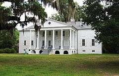
Hampton Plantation |
|
000000001970-04-15-0000April 15, 1970
(#70000582) |
McClellanville
33°11′54″N 79°26′16″W / 33.198333°N 79.437778°W / 33.198333; -79.437778 (Hampton Plantation) |
Charleston |
"South Carolina's finest example of a large two-and-a-half frame Georgian plantation house"
|
| 29 |
Dubose Heyward House |
|
000000001971-11-11-0000November 11, 1971
(#71000749) |
Charleston
32°46′29″N 79°55′45″W / 32.774663°N 79.929029°W / 32.774663; -79.929029 (Dubose Heyward House) |
Charleston |
Home of Dubose Heyward, author of the novel Porgy.
|
| 30 |
Heyward-Washington House |
|
000000001970-04-15-0000April 15, 1970
(#70000576) |
Charleston
32°46′31″N 79°55′45″W / 32.775337°N 79.929125°W / 32.775337; -79.929125 (Heyward-Washington House) |
Charleston |
Residence of George Washington during his 1792 visit to Charleston
|
| 31 |
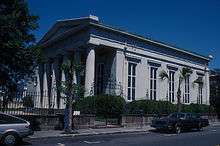
Hibernian Hall |
|
000000001973-11-07-0000November 7, 1973
(#73001686) |
Charleston
32°46′39″N 79°55′52″W / 32.777469°N 79.931148°W / 32.777469; -79.931148 (Hibernian Hall) |
Charleston |
|
| 32 |
Hopsewee |
|
000000001971-11-11-0000November 11, 1971
(#71000782) |
Georgetown
33°12′38″N 79°23′05″W / 33.210556°N 79.384722°W / 33.210556; -79.384722 (Hopsewee) |
Georgetown |
Plantation mansion built in 1749; the birthplace of Thomas Lynch, Jr.
|
| 33 |
Huguenot Church |
|
000000001973-11-07-0000November 7, 1973
(#73001687) |
Charleston
32°46′41″N 79°55′46″W / 32.778090°N 79.929312°W / 32.778090; -79.929312 (Huguenot Church) |
Charleston |
Gothic Revival church built in 1844; designed by architect E. B. White
|
| 34 |
Kahal Kadosh Beth Elohim |
|
000000001980-06-19-0000June 19, 1980
(#78002499) |
Charleston
32°46′55″N 79°55′59″W / 32.781979°N 79.932948°W / 32.781979; -79.932948 (Kahal Kadosh Beth Elohim) |
Charleston |
Greek revival building from 1840; second oldest synagogue in continuous use in the United States
|
| 35 |
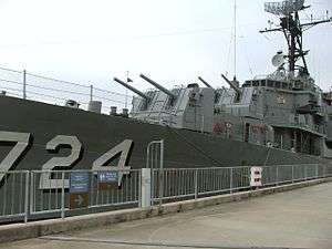
USS Laffey |
|
000000001986-01-14-0000January 14, 1986
(#83002189) |
Mount Pleasant
32°47′16″N 79°54′28″W / 32.787883°N 79.907744°W / 32.787883; -79.907744 (USS Laffey) |
Charleston |
A destroyer
|
| 36 |
Lancaster County Courthouse |
|
000000001973-11-07-0000November 7, 1973
(#71000788) |
Lancaster
34°43′17″N 80°46′17″W / 34.721264°N 80.771369°W / 34.721264; -80.771369 (Lancaster County Courthouse) |
Lancaster |
Courthouse in continuous use since 1828; designed by Robert Mills
|
| 37 |
Lancaster County Jail |
|
000000001973-11-07-0000November 7, 1973
(#71000789) |
Lancaster
34°43′06″N 80°46′17″W / 34.718335°N 80.771270°W / 34.718335; -80.771270 (Lancaster County Jail) |
Lancaster |
|
| 38 |
Joseph Manigault House |
|
000000001973-11-07-0000November 7, 1973
(#73001688) |
Charleston
32°47′19″N 79°56′08″W / 32.788703°N 79.935558°W / 32.788703; -79.935558 (Joseph Manigault House) |
Charleston |
Home designed by Gabriel Manigault for his brother
|
| 39 |
Market Hall and Sheds |
|
000000001973-11-07-0000November 7, 1973
(#73001689) |
Charleston
32°46′51″N 79°55′53″W / 32.780720°N 79.931515°W / 32.780720; -79.931515 (Market Hall and Sheds) |
Charleston |
Greek Revival meat market with two blocks of sheds where vegetables, fish, etc., were sold
|
| 40 |
Marshlands |
|
000000001973-11-07-0000November 7, 1973
(#73001674) |
Beaufort
32°26′01″N 80°39′57″W / 32.433520°N 80.665831°W / 32.433520; -80.665831 (Marshlands) |
Beaufort |
Home of Dr. James Robert Verdier, who discovered a treatment for yellow fever
|
| 41 |
Middleburg Plantation |
|
000000001970-04-15-0000April 15, 1970
(#70000568) |
Huger
33°04′52″N 79°50′35″W / 33.081111°N 79.843056°W / 33.081111; -79.843056 (Middleburg Plantation) |
Berkeley |
One of the earliest frame plantation houses in the state
|
| 42 |
Middleton Place |
|
000000001971-11-11-0000November 11, 1971
(#71000770) |
Summerville
32°53′59″N 80°08′12″W / 32.899722°N 80.136667°W / 32.899722; -80.136667 (Middleton Place) |
Dorchester |
Plantation mansion and ornamental gardens on the Ashley River
|
| 43 |
Millford Plantation |
|
000000001973-11-07-0000November 7, 1973
(#71000808) |
Pinewood
33°44′54″N 80°32′15″W / 33.7484°N 80.53745°W / 33.7484; -80.53745 (Millford Plantation) |
Sumter |
A monumental 2-story Greek Revival mansion built in 1839 and meticulously restored in the early 1990s.
|
| 44 |
Mills Building, South Carolina State Hospital |
|
000000001973-11-07-0000November 7, 1973
(#70000890) |
Columbia
34°00′55″N 81°02′03″W / 34.015160°N 81.034151°W / 34.015160; -81.034151 (Mills Building, South Carolina State Hospital) |
Richland |
Designed by Robert Mills, used from 1827 to 1937; "the oldest building in the country to be used continuously as a mental institution and one of the first mental hospitals built with public funds"
|
| 45 |
Clark Mills Studio |
|
000000001965-12-21-0000December 21, 1965
(#66000703) |
Charleston
32°46′36″N 79°55′46″W / 32.776597°N 79.929503°W / 32.776597; -79.929503 (Clark Mills Studio) |
Charleston |
Studio of self-taught sculptor Clark Mills
|
| 46 |
Robert Mills House |
|
000000001973-11-07-0000November 7, 1973
(#70000595) |
Columbia
34°00′34″N 81°01′45″W / 34.009444°N 81.029167°W / 34.009444; -81.029167 (Robert Mills House) |
Richland |
Home designed by architect Robert Mills
|
| 47 |
Mulberry Plantation |
|
000000001960-10-09-0000October 9, 1960
(#66000697) |
Moncks Corner
33°08′31″N 80°01′04″W / 33.141944°N 80.017778°W / 33.141944; -80.017778 (Mulberry Plantation) |
Berkeley |
Built in 1714 for a Royal governor; one of the earliest plantation homes in the United States
|
| 48 |
Mulberry Plantation (James and Mary Boykin Chesnut House) |
|
000000002000-02-16-0000February 16, 2000
(#80003673) |
Camden
34°12′24″N 80°35′31″W / 34.206528°N 80.591944°W / 34.206528; -80.591944 (Mulberry Plantation (James and Mary Boykin Chesnut House)) |
Kershaw |
Home of Mary Boykin Chesnut and source for her Civil War-time diary describing southern society, "acknowledged as the most important piece of Confederate literature"
|
| 49 |
Ninety-Six and Star Fort |
|
000000001973-11-07-0000November 7, 1973
(#69000169) |
Ninety Six
34°08′49″N 82°01′28″W / 34.146944°N 82.024444°W / 34.146944; -82.024444 (Ninety-Six and Star Fort) |
Greenwood |
|
| 50 |
Old Marine Hospital |
|
000000001973-11-07-0000November 7, 1973
(#73001690) |
Charleston
32°46′39″N 79°56′15″W / 32.777621°N 79.937483°W / 32.777621; -79.937483 (Old Marine Hospital) |
Charleston |
Gothic Revival design by Robert Mills built in 1833 to serve sick sailors and other transients
|
| 51 |
Parish House of the Circular Congregational Church |
|
000000001973-11-07-0000November 7, 1973
(#73001683) |
Charleston
32°46′45″N 79°55′53″W / 32.779032°N 79.931308°W / 32.779032; -79.931308 (Parish House of the Circular Congregational Church) |
Charleston |
Parish house designed by Robert Mills
|
| 52 |
Penn School Historic District |
|
000000001974-12-02-0000December 2, 1974
(#74001824) |
Frogmore
32°23′18″N 80°34′31″W / 32.3883°N 80.5753°W / 32.3883; -80.5753 (Penn School Historic District) |
Beaufort |
School for freed slaves, Gullahs, on St. Helena Island which was occupied by the Union near the outset of the American Civil War
|
| 53 |
Pompion Hill Chapel |
|
000000001970-04-15-0000April 15, 1970
(#70000567) |
Huger
33°05′12″N 79°50′12″W / 33.086667°N 79.836667°W / 33.086667; -79.836667 (Pompion Hill Chapel) |
Berkeley |
Episcopal chapel built in 1763, unaltered
|
| 54 |
Powder Magazine |
|
000000001989-09-27-0000September 27, 1989
(#72001200) |
Charleston
32°46′47″N 79°55′47″W / 32.779656°N 79.929791°W / 32.779656; -79.929791 (Powder Magazine) |
Charleston |
The oldest public building in the city
|
| 55 |
Joseph H. Rainey House |
|
000000001984-04-20-0000April 20, 1984
(#84003877) |
Georgetown
33°22′07″N 79°17′02″W / 33.368607°N 79.283817°W / 33.368607; -79.283817 (Joseph H. Rainey House) |
Georgetown |
Home of the first black U.S. Congressman, Joseph H. Rainey, a former slave
|
| 56 |
Robert Barnwell Rhett House |
|
000000001973-11-07-0000November 7, 1973
(#73001691) |
Charleston
32°47′11″N 79°56′33″W / 32.786250°N 79.942502°W / 32.786250; -79.942502 (Robert Barnwell Rhett House) |
Charleston |
Home of Robert Barnwell Rhett, an extreme secessionist politician, a leading fire-eater at the Nashville Convention of 1850, which failed to endorse his aim of secession
|
| 57 |
Robert William Roper House |
|
000000001973-11-07-0000November 7, 1973
(#73001692) |
Charleston
32°46′14″N 79°55′42″W / 32.770529°N 79.928419°W / 32.770529; -79.928419 (Robert William Roper House) |
Charleston |
|
| 58 |
Nathaniel Russell House |
|
000000001973-11-07-0000November 7, 1973
(#71000750) |
Charleston
32°46′27″N 79°55′51″W / 32.774177°N 79.930737°W / 32.774177; -79.930737 (Nathaniel Russell House) |
Charleston |
Adamesque home completed in 1811
|
| 59 |
Edward Rutledge House |
|
000000001971-11-11-0000November 11, 1971
(#71000751) |
Charleston
32°46′34″N 79°56′01″W / 32.776202°N 79.933560°W / 32.776202; -79.933560 (Edward Rutledge House) |
Charleston |
Home of Edward Rutledge, a signer of the Declaration of Independence, and a governor of South Carolina
|
| 60 |
John Rutledge House |
|
000000001973-11-07-0000November 7, 1973
(#71000752) |
Charleston
32°46′34″N 79°56′01″W / 32.776231°N 79.933563°W / 32.776231; -79.933563 (John Rutledge House) |
Charleston |
Home of Gov. John Rutledge, a signer of the U.S. Constitution.
|
| 61 |
St. James Church, Goose Creek |
|
000000001970-04-15-0000April 15, 1970
(#70000566) |
Goose Creek
32°58′25″N 80°01′47″W / 32.973616°N 80.029594°W / 32.973616; -80.029594 (St. James Church, Goose Creek) |
Berkeley |
Episcopal chapel
|
| 62 |
St. James Church, Santee |
|
000000001970-04-15-0000April 15, 1970
(#70000581) |
Georgetown
33°10′13″N 79°27′56″W / 33.170166°N 79.46569°W / 33.170166; -79.46569 (St. James Church, Santee) |
Charleston |
|
| 63 |
Saint Michael's Episcopal Church |
|
000000001960-10-09-0000October 9, 1960
(#66000704) |
Charleston
32°46′33″N 79°55′51″W / 32.775963°N 79.930931°W / 32.775963; -79.930931 (Saint Michael's Episcopal Church) |
Charleston |
Built in 1750s, Charleston's oldest church building
|
| 64 |
St. Philip's Episcopal Church |
|
000000001973-11-07-0000November 7, 1973
(#73001695) |
Charleston
32°46′44″N 79°55′46″W / 32.778874°N 79.929469°W / 32.778874; -79.929469 (St. Philip's Episcopal Church) |
Charleston |
Church with E. B. White-designed steeple
|
| 65 |
St. Stephen's Episcopal Church |
|
000000001970-04-15-0000April 15, 1970
(#70000570) |
St. Stephen
33°24′19″N 79°55′00″W / 33.4054°N 79.9166°W / 33.4054; -79.9166 (St. Stephen's Episcopal Church) |
Berkeley |
A small Georgian brick country church with a high gambrel roof.
|
| 66 |
Simmons-Edwards House |
|
000000001973-11-07-0000November 7, 1973
(#71000753) |
Charleston
32°46′22″N 79°56′02″W / 32.7729°N 79.93397°W / 32.7729; -79.93397 (Simmons-Edwards House) |
Charleston |
Known as the "Pineapple Gate House" by locals, referring to finials upon its large brick gates
|
| 67 |
Robert Smalls House |
|
000000001973-05-30-0000May 30, 1973
(#74001823) |
Beaufort
32°26′07″N 80°40′05″W / 32.435156°N 80.668186°W / 32.435156; -80.668186 (Robert Smalls House) |
Beaufort |
Post-Civil War home of U.S. congressman Robert Smalls, a former slave who commandeered a Confederate ship out to Union lines
|
| 68 |
Snee Farm |
|
000000001973-11-07-0000November 7, 1973
(#73001702) |
Mount Pleasant
32°50′46″N 79°49′29″W / 32.846111°N 79.824722°W / 32.846111; -79.824722 (Snee Farm) |
Charleston |
Home of early South Carolina Governor Charles Pinckney.
|
| 69 |
Snow's Island |
Upload image |
000000001974-12-02-0000December 2, 1974
(#73001708) |
Across the Peedee River from Dunham Bluff, near Johnsonville[10]
33°50′13″N 79°20′28″W / 33.8369°N 79.3411°W / 33.8369; -79.3411 (Snow's Island) |
Florence |
Revolutionary War era refuge of the "Swamp Fox", Francis Marion
|
| 70 |
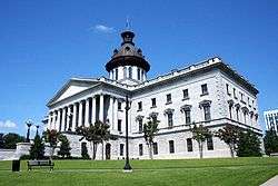
South Carolina State House |
|
000000001976-05-11-0000May 11, 1976
(#70000598) |
Columbia
34°00′02″N 81°01′59″W / 34.000433°N 81.033147°W / 34.000433; -81.033147 (South Carolina State House) |
Richland |
This Greek Revival capitol building was completed in 1907, with major renovations in 1959 and 1998.
|
| 71 |
Stono River Slave Rebellion Site |
|
000000001974-05-30-0000May 30, 1974
(#74001840) |
Rantowles
32°47′08″N 80°08′44″W / 32.785501°N 80.145560°W / 32.785501; -80.145560 (Stono River Slave Rebellion Site) |
Charleston |
Beginning point of the earliest slave revolt in the United States.
|
| 72 |
Colonel John Stuart House |
|
000000001973-11-07-0000November 7, 1973
(#70000578) |
Charleston
32°46′28″N 79°56′02″W / 32.774370°N 79.933807°W / 32.774370; -79.933807 (Colonel John Stuart House) |
Charleston |
Home of Colonel John Stuart.
|
| 73 |
Unitarian Church |
|
000000001973-11-07-0000November 7, 1973
(#73001696) |
Charleston
32°46′41″N 79°56′04″W / 32.778149°N 79.934554°W / 32.778149; -79.934554 (Unitarian Church) |
Charleston |
Church built in 1772 and reworked in Gothic style during 1852-1854
|
| 74 |
Denmark Vesey House |
|
000000001976-05-11-0000May 11, 1976
(#76001698) |
Charleston
32°46′56″N 79°56′28″W / 32.782209°N 79.941180°W / 32.782209; -79.941180 (Denmark Vesey House) |
Charleston |
Said to be the home of Denmark Vesey, who was accused of plotting slave rebellion in 1822 and executed
|
| 75 |
Woodlands |
|
000000001971-11-11-0000November 11, 1971
(#71000742) |
Bamberg
33°17′27″N 80°55′53″W / 33.29085°N 80.931271°W / 33.29085; -80.931271 (Woodlands) |
Bamberg |
The primary residence of author William Gilmore Simms, whose main house was burned in 1865; the remaining wing and several outbuildings constitute a literary landmark.
|
| 76 |
USS Yorktown |
|
000000001986-01-14-0000January 14, 1986
(#82001519) |
Mount Pleasant
32°47′20″N 79°54′31″W / 32.788792°N 79.908588°W / 32.788792; -79.908588 (USS Yorktown) |
Charleston |
Famous World War II aircraft carrier |

.jpg)
.jpg)

.jpg)
.jpg)
.jpg)
.jpg)
.jpg)
.jpg)
.jpg)
.jpg)
.jpg)

.jpg)


.jpg)


.jpg)
.jpg)
%2C_Lancaster%2C_South_Carolina.jpg)
_Jail.jpg)


.jpg)


.jpg)

.jpg)
.jpg)
.jpg)
.jpg)

.jpg)

.jpg)
.jpg)

.jpg)
.jpg)
.jpg)
.jpg)
.jpg)
.jpg)
.jpg)


.jpg)

.jpg)
