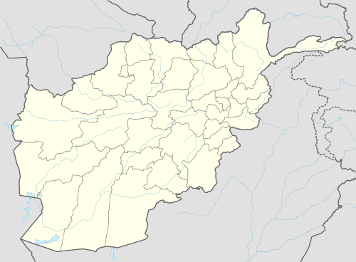
Parun
| Parun پارون | |
|---|---|
 Parun Location in Afghanistan | |
| Coordinates: 35°25′0″N 70°55′01″E / 35.41667°N 70.91694°ECoordinates: 35°25′0″N 70°55′01″E / 35.41667°N 70.91694°E | |
| Country |
|
| Province | Nuristan Province |
| District | Parun District |
| Elevation | 2,265 m (7,431 ft) |
| Population | |
| • City | 1,000 |
| • Urban | 1,647 [1] |
| Time zone | Afghanistan Standard Time (UTC+4:30) |
Pârûn (پارون), also called Prasûn and Prasungul, is a small town and administrative center of Nuristan Province and its Parun District in Afghanistan.
The city of Parun has a population of 1,647. [2] It has 1 district and a total land area of 350 Hectar. [3] The total number of dwellings in Parun is 1,647. [4]
Land Use
Paroon is an Urban Village in northeastern Afghanistan with only 350 hectares and 183 dwellings. [5] Paroon is predominately forest land (54%) followed by agriculture (33%). [6] Built-up land only accounts for 7% of total land use. [7] But unlike many other cities, Paroon does not have any barren land and only 4 hectares of vacant plots. [8]
Geography
Parun has 6 villages: Ishtewi, Pronz, Dewa, Kushteki, Tsutsum and Pashki. They are located over a distance of 20 km from north to south along the Parun River. Ishtewi, the upper village, lies at an altitude of 2,850 m above sea level, while Pashki, the lowest village, lies at 2,500 m above sea level .
Plans for a city
According to news published in 2007, the governor of Nuristan Province was planning to establish a city of about 20,000 people in Parun. This would make it "the first city in Nuristan." The report indicated that some construction had begun.[9]
Languages
Wasi-wari is natively spoken in Parun, while Kamkata-viri, Pashto and Dari are also understood.
References
- ↑ "The State of Afghan Cities report2015".
- ↑ "The State of Afghan Cities report2015".
- ↑ "The State of Afghan Cities report 2015".
- ↑ "The State of Afghan Cities report 2015".
- ↑ "The State of Afghan Cities report 2015".
- ↑ "The State of Afghan Cities report 2015".
- ↑ "The State of Afghan Cities report 2015".
- ↑ "The State of Afghan Cities report 2015".
- ↑ Afghan Governor Has Big Plans for Lonely Province, Soraya Sarhaddi Nelson, National Public Radio, 13 November 2007, ... The 50-year-old governor says Parun — the first city in Nuristan — is only the beginning for a province where residents farm and raise goats to survive ...